Share to: share facebook share twitter share wa share telegram print page

Carter, Texas

Carter, Texas
Carter is located in Texas
Carter
Carter
Carter is located in the United States
Carter
Carter
Coordinates: 32°54′22″N 97°44′19″W / 32.90611°N 97.73861°W / 32.90611; -97.73861
CountryUnited States
StateTexas
CountyParker
Area
 • Total6.44 sq mi (16.68 km2)
 • Land6.43 sq mi (16.65 km2)
 • Water0.02 sq mi (0.04 km2)
Elevation
1,070 ft (330 m)
Time zoneUTC-6 (Central (CST))
 • Summer (DST)UTC-5 (CDT)
ZIP Codes
76082 (Springtown)
76085 (Weatherford)
Area code(s)817, 682
FIPS code48-13075
GNIS feature ID2805831[2]

Carter is an unincorporated area and census-designated place (CDP) in Parker County, Texas, United States. It was first listed as a CDP prior to the 2020 census.[2]

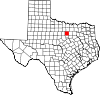
It is in the northern part of the county, spread over several low ridges and valleys draining south to the Clear Fork of the Trinity River and north to Walnut Creek, a tributary of the West Fork of the Trinity River. Texas State Highway 51 passes through the east side of the CDP, leading northeast 5 miles (8 km) to Springtown and southwest 10 miles (16 km) to Weatherford, the Parker county seat. Fort Worth is 29 miles (47 km) to the southeast.

References

  1. ^ "2020 U.S. Gazetteer Files – Texas". United States Census Bureau. Retrieved September 30, 2021.
  2. ^ a b "Carter Census Designated Place". Geographic Names Information System. United States Geological Survey, United States Department of the Interior.


Kembali kehalaman sebelumnya