Ghverteti
Ghverteti (en georgiano: ღვერთეთი) o Kumau (en osetio: Къуымау) es una aldea que pertenece a la parcialmente reconocida República de Ose…
| Ghverteti • Kumau ღვერთეთი • Къуымау | ||
|---|---|---|
| Aldea | ||
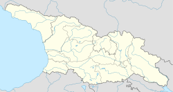
  Ghverteti • Kumau Localización de Ghverteti • Kumau en Georgia | ||
 Ghverteti • Kumau Localización de Ghverteti • Kumau en Osetia del Sur | ||
| Coordenadas | 42°13′04″N 43°51′37″E / 42.217777777778, 43.860277777778 | |
| Entidad | Aldea | |
| • País |
 Georgia Georgia | |
| • Territorio |
 Osetia del Sur Osetia del Sur | |
| • Región | Iberia Interior | |
| • Distrito (de facto) | Znaur | |
| • Municipio (de iure) |
 Tighvi Tighvi | |
| Altitud | ||
| • Media | 880 m s. n. m. | |
| Población (2015) | ||
| • Total | 30 hab. | |
Ghverteti (en georgiano: ღვერთეთი) o Kumau (en osetio: Къуымау) es una aldea que pertenece a la parcialmente reconocida República de Osetia del Sur, parte del distrito de Znaur, aunque de iure pertenece al municipio de Tighvi de la región de Iberia Interior de Georgia.[1]
Geografía
Ghverteti se encuentra a orillas del río Froni Oriental, a 19 km de Kornisi.
Historia
De 1922 a 1990, formó parte del distrito de Znaur del óblast autónomo de Osetia del Sur, siendo de mayoría osetia.[2] De 1990 a 2006, formó parte del raión de Kareli y, desde 2006, forma parte del municipio de Tighva.
Demografía
La evolución demográfica de Ghverteti entre 1939 y 2015 fue la siguiente:
Según el censo soviético de 1959, la mayoría de la población local eran osetios.[5] En los distintos censos, la composición étnica del pueblo es la siguiente:
| 1989[6] | ||
|---|---|---|
| Grupo étnico | Población | Porcentaje |
| Georgianos | 0 | 0% |
| Osetios | 39 | 100% |
| Total | 39 | 100% |
Referencias
- ↑ The Georgian Soviet Encyclopedia, Volume 1, Tbilisi, 1975. - p. 308.
- ↑ «сёла Знаурского района 1959». ethno-kavkaz.narod.ru. Consultado el 22 de noviembre de 2024.
- ↑ «Перепись населения Южная Осетия». http://www.ethno-kavkaz.narod.ru. Consultado el 17 de mayo de 2023.
- ↑ «Итоги всеобщей переписи населения Республики Южная Осетия 2015 года». Consultado el 17 de mayo de 2023.
- ↑ «Сёла Знаурский района 1959 г. (см. Заккорский сельсовет)». Archivado desde el original el 11 de enero de 2014. Consultado el 27 de septiembre de 2010.
- ↑ «Перечень сёл Южной Осетии и население в 1989 году». Archivado desde el original el 21 de marzo de 2012. Consultado el 30 de septiembre de 2023.
| Control de autoridades |
|
|---|

 Datos: Q16377520
Content Disclaimer
Informasi ini disarikan dari Wikipedia dan disajikan kembali untuk tujuan edukasi. Konten tersedia di bawah lisensi CC BY-SA 3.0. Kami tidak bertanggung jawab atas ketidakakuratan data yang bersumber dari kontribusi publik tersebut.
- The information displayed on this website is sourced in part or in whole from Wikipedia and has been adapted for the purpose of restating it. We strive to provide accurate and relevant information, however:
- There is no guarantee of absolute accuracy. Wikipedia is an open, collaborative project that can be edited by anyone, so information is subject to change.
- It is not intended to constitute professional advice. The content displayed is for informational and educational purposes only. For important decisions (e.g., medical, legal, or financial), please consult a professional.
- Content copyright. Wikipedia is licensed under the Creative Commons Attribution-ShareAlike License (CC BY-SA). This means that content may be reused with appropriate attribution and shared under a similar license.
- Responsible use. Any risk arising from the use of information from this website is entirely the responsibility of the user.